Every day, one story that matters, broken down into three numbered scenarios, each with its own probability. Never fixed — it shifts as the situation changes.
Scénario
Monday, geopolitics
Climate: world borders in 2050
Will climate change redraw world borders by 2050, amid the opening of new Arctic routes, continental shelf claims, and climate migration?
Publié le 26 octobre 2026
Share:
The facts
The point, in plain terms
Melting polar ice and climate disruption are transforming global geography and rekindling sharp territorial rivalries.
What is happening? Global warming is opening new sea lanes at the North Pole while making habitable land scarcer in the Global South. What is the issue? Multiple major powers, including Russia, Canada, and Denmark, are claiming the same seabed areas in the Arctic. At the same time, millions of residents will have to relocate within their countries due to droughts or floods. Why does it matter? These developments disrupt international maritime law, threaten the stability of borders, and force Europe to overhaul its collective defense.
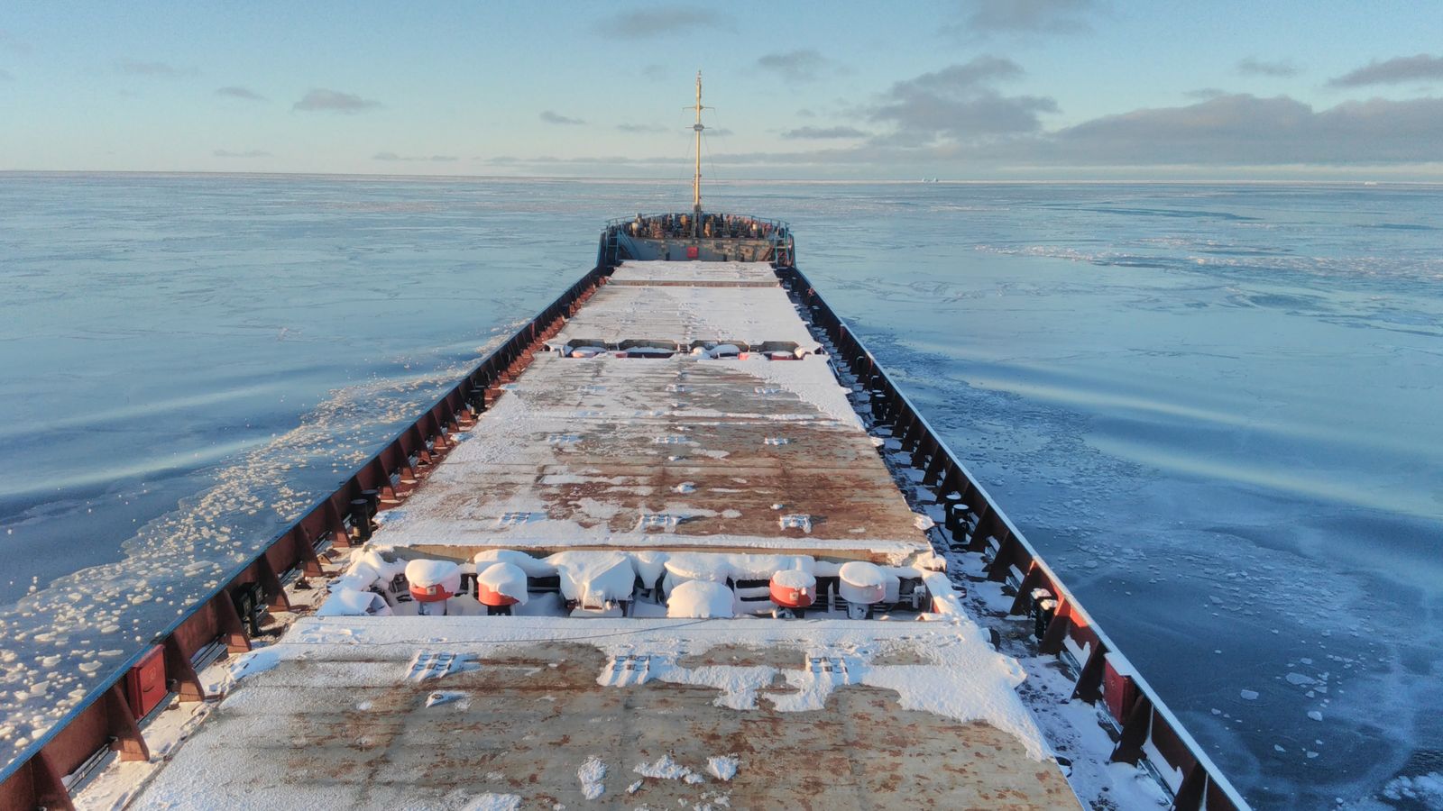
The accelerating melt of polar sea ice is turning the Arctic Ocean into a new arena of direct rivalries between major powers. Long locked beneath a thick sheet of ice, the North Pole is becoming navigable for several months each year. This physical shift is drawing keen interest from key coastal states such as Russia, Canada, and Denmark, as well as the North Atlantic Treaty Organization*, the Western military alliance known as NATO. Each seeks to secure undersea resources and strategic transit corridors. As a result, the global geopolitical balance is shifting toward the High North—a region where maritime boundaries remain broadly disputed due to a lack of definitive treaties.
The retreating ice is notably clearing the Northern Sea Route*, a shipping lane hugging the Siberian coast between Europe and Asia. For merchant vessels, this route cuts transit times by nearly ten days compared with the standard passage through the Suez Canal. The data underscores this commercial surge: transit traffic reached 103 voyages in 2025, up from 97 in 2024, and had already recorded 104 voyages as of September 30, 2026. Moscow keeps a tight grip on this corridor, mandating fee-based icebreaker escorts and advance permits. This Russian control alarms Western powers, which demand unhindered freedom of navigation in international waters.
Beneath the surface, another quiet contest is unfolding on the ocean floor over access to minerals and fossil fuels. Under maritime law, a coastal state can extend its exclusive seabed rights if it proves that its land territory naturally continues underwater. This is the extended continental shelf* principle. In March 2026, Russia submitted a revised technical filing to the UN claiming the Lomonosov Ridge, a vast underwater mountain range. Yet Canada and Denmark, via Greenland, also claim that this same geological formation belongs to them. The relevant UN commission must rule on the evidence, but its scientific recommendations do not automatically constitute binding border agreements.
Understanding it
How the UN delineates underwater borders in the Arctic
Picture a table whose legs you want to extend beneath a tablecloth. The UN Commission on the Limits of the Continental Shelf evaluates geological data to confirm whether the seabed is a natural prolongation of a country’s land territory. If proven, the state secures exclusive rights to seabed resources up to 350 nautical miles out, without owning the water column above.
Faced with Russian claims and the growing presence of Chinese interests, Western nations are bolstering their regional defense posture. In 2026, the Atlantic alliance launched Arctic Sentry*, a joint surveillance and military coordination mission in the High North. Multinational forces are now stationed in Finland and Norway to protect Europe’s northern flank. This deployment marks a departure from decades of peaceful scientific cooperation. The Arctic frontier is turning into an armed line of contact where any naval or aerial maneuver risks triggering severe diplomatic clashes between the Western bloc and Moscow.
At the other end of the spectrum, climate disruption is also reshaping human geography far beyond the frozen poles. Rising sea levels and recurring extreme droughts are rendering vast tracts of farmland uninhabitable across Africa and South Asia. According to projections from the World Bank and the Intergovernmental Panel on Climate Change*, known as the IPCC, between 44 million and 216 million people could be forced to migrate within their own borders by 2050. If local investments fail to absorb these internal displacements, they will inevitably spill over into regional and international borders.
Understanding it
Why climate migration figures vary so widely
Estimating the number of climate-displaced people is like making a 30-year weather forecast. The spread between 44 million and 216 million people hinges directly on the speed of the global green transition. If governments build sea walls and irrigation networks, communities stay put; without investment, entire regions are forced to leave.
These three physical shifts—new shipping corridors, seabed division, and mass population movements—are converging at the same historical moment. No binding global treaty governs both climate change and the territorial disputes born of global warming. International law relies on state consent, yet major powers frequently favor power politics over negotiated compromises. The next thirty years will thus determine whether the world manages these emerging borders through multilateral dialogue or through a succession of sharp territorial and security crises. Three scenarios outline the future of this rapidly redrawn global map.
Transit traffic along the Northern Sea Route (voyages/year)103 voyages in 2025 up (+6.2% vs. 2024)
Projections for internal climate migration by 205044M to 216M people range based on IPCC and World Bank scenarios
Les chiffres
Le trafic de transit sur la Route maritime du Nord progresse, illustrant l'ouverture progressive de la route arctique.
2024
97 voyages
2025
103 voyages
2026 (au 30 sept.)
104 voyages
Source : CHNL (Centre de gestion de la navigation de la Route maritime du Nord), données 2024, 2025 et 2026 au 30 septembre.
Three scenarios for world borders and the Arctic by 2050
What we're assessing
FavorableUn accord technique à l'ONU délimite les fonds marins et le trafic arctique respecte le droit international.
StableLes revendications restent gelées sans accord global et la Russie conserve le contrôle de la route nordique.
DégradéLes litiges en Arctique tournent à la confrontation militaire et les flux migratoires saturent les frontières.
Favorable
25%
Unlikely
Negotiated seabed division and freedom of navigation in the Arctic
In this scenario, the UN Commission successfully delivers precise technical recommendations that Russia, Canada, and Denmark agree to negotiate peacefully. Governments agree on a shared boundary along the Lomonosov Ridge, averting any military escalation. The Northern Sea Route opens under a transparent international framework guaranteeing freedom of navigation for all commercial fleets. In practice, Western and Asian shippers use the corridor without facing extortionate fees or Russian political pressure. Meanwhile, massive investments in climate adaptation keep population displacements near the lower bound of 44 million people.
Compared with the other two pathways, this outcome relies on a multilateral diplomatic breakthrough that is rare in today’s geopolitical climate. It assumes Moscow agrees to share control of an area it currently treats as an exclusive sovereign sanctuary. Such a peaceful resolution would require a lasting easing of tensions between NATO and Russia, sharply reducing the risk of armed confrontation along Europe’s northern borders.
Indicators affected
Trafic de transit sur la Route maritime du Nordplus de 250 voyages par an↑103 voyages en 2025
Migrations climatiques internes à l'horizon 205044 millions de personnes (scénario bas)↓44 à 216 millions
The France angleSecuring maritime shipping lanes lowers freight costs and protects French maritime interests. ↑ Rather favorable for France.
Stable
50%
Likely
Contested status quo and Russian control over the northern route
In this baseline scenario, the UN Commission continues to produce expert reports without securing a comprehensive compromise among the three coastal states. Competing claims remain in legal limbo for years. At sea, Russia maintains tight surveillance over the Northern Sea Route, unilaterally setting escort fees and transit rules. In practice, shipping traffic grows steadily without a dramatic surge, reaching around 150 to 200 voyages per year by 2035, primarily run by Moscow’s partners such as China. Climate migration proceeds at a moderate pace without triggering an immediate collapse of border controls.
Unlike an outright breakdown or an ideal settlement, this path extends current rivalries below the threshold of direct confrontation. The Atlantic alliance maintains its Arctic Sentry mission to track Russian activities without attempting a naval blockade. This middle ground sustains a fragile equilibrium, but one that could unravel at the first uncontained maritime incident in icy waters.
Indicators affected
Trafic de transit sur la Route maritime du Nord150 à 180 voyages par an↑103 voyages en 2025
Migrations climatiques internes à l'horizon 2050autour de 120 millions de personnes→44 à 216 millions
The France angleFrance must sustain a permanent military presence in the High North within NATO. ↓ Rather unfavorable for France.
Degraded
25%
Unlikely
Militarization of the North Pole and border migration crisis
In this adverse outlook, Russia rejects any challenge to its Arctic borders and heavily militarizes its coastal outposts. Moscow enforces severe access restrictions on NATO-flagged vessels, turning the shipping lanes into a permanent flashpoint. In response, Western forces ramp up freedom of navigation patrols across contested continental shelf zones. In practice, global maritime trade fragments, and military tensions extinguish any hope of shared governance. Concurrently, climate inaction forces over 200 million internal refugees to move across developing nations, generating intense migration pressures on the Mediterranean basin and Europe.
Compared with the status quo, this scenario pairs a security crisis along northern frontiers with severe political instability on southern borders. UN diplomacy is entirely sidelined by armed bloc politics. This shift permanently alters the strategic geography of the European continent and undermines the stability of Western democracies.
Indicators affected
Trafic de transit sur la Route maritime du Nordmoins de 50 voyages commerciaux↓103 voyages en 2025
Migrations climatiques internes à l'horizon 2050plus de 210 millions de personnes (scénario haut)↑44 à 216 millions
The France angleThe French military would be forced to increase its polar defense budget in response to the Russian threat and migration flows. ↓ Rather unfavorable for France.
Ordres de grandeur indicatifs pour les 3 scénarios ci-dessus, estimés avec l'information disponible à la publication et réévalués si la situation change — jamais des prévisions garanties. Learn more about our method → · How to read a probability →
Key takeaways
Will global warming and melting polar ice force major powers to redraw world borders by 2050?
Traffic along the Northern Sea Route reached 103 voyages in 2025 and 104 voyages as of September 30, 2026, while Russia, Canada, and Denmark contest the Arctic continental shelf before the UN.
No, not through formal treaties: our most likely scenario (50%) points to a contentious status quo where Russia retains de facto control over the northern route—two other outcomes remain possible: a multilateral deal (25%) or open military confrontation (25%).
The key signals to watch will be the release of upcoming technical recommendations by the UN Commission on the Lomonosov Ridge and maneuvers under NATO’s Arctic Sentry mission.
Moderately negative
Our assessment of the impact for France: moderately negative.due to a combined 75% probability that Arctic tensions will persist or worsen, imposing higher security costs on our armed forces.
Si tu devais retenir 1 chose
Le trafic sur la Route maritime du Nord a atteint 103 voyages en 2025, illustrant la pression géopolitique grandissante sur les frontières de l'Arctique.
Don't miss the next edition:
For those new to the topic
Quick glossary
North Atlantic Treaty Organization
Defensive military alliance bringing together European and North American nations, including France.
Northern Sea Route
Maritime shipping lane along the Russian Arctic coast, connecting the Atlantic and Pacific Oceans.
extended continental shelf
Underwater extension of a country’s landmass over which the state can exercise exclusive rights to seabed resources.
Arctic Sentry
Military surveillance and deterrence mission launched by NATO in 2026 to secure the High North.
Intergovernmental Panel on Climate Change
International scientific body tasked with assessing the state of knowledge on global warming.